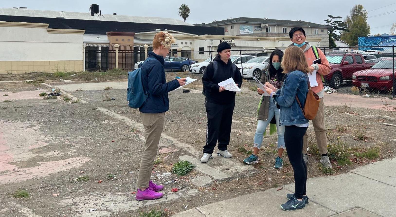
It was a brisk October morning in downtown Richmond, when community members gathered at a vacant lot on MacDonald Ave, Richmond’s historic mainstreet, and 16th St, across from the Richmond BART station. Some of the group who live nearby mentioned that the lot had been vacant for as long as they could remember. Mostly everyone agreed that these types of vacant lots around town were so common, they barely noticed them anymore.
The group consisted of lifetime Richmond residents and members of local community based organizations: Alliance of Californians for Community Empowerment (ACCE); and RichmondLAND, a community land trust and grantee of the Partnership for the Bay’s Future’s (PBF) Policy Grants. As a PBF Fellow, I’m working to strengthen cross-sectoral collaboration between the community, RichmondLAND and the City of Richmond’s Community Development department – bringing the community’s voice to the policy-making process. The land we stood on is owned by the City of Richmond, designated “surplus land” in compliance with a state law called the Surplus Land Act, and I gathered this group to hear their thoughts on developing land like this.

The Surplus Land Act
The Surplus Land Act – updated by AB1486 in 2020 – requires that unused public land be prioritized for affordable housing while reducing cost barriers to housing development. The bill defines “surplus” as land owned by any local government agency that is not necessary for the agency’s use. The government agency must then make land available for affordable housing before selling or leasing the land for another purpose. The City of Richmond has identified 14 sites as surplus, and our group had planned a walking tour of 8 of those sites.
In spite of its desolate makeup of litter, fractured pavement and overgrown grass, the group imagined the vacant lot transformed into housing and the powerful impact this could have at such a visible location. Led by RichmondLAND’s staff, community members discussed the need for permanently affordable housing, community controlled housing through a land trust model, and housing for large families in order to address overcrowding in housing.
After gathering at the first lot, we walked down MacDonald Ave, stopping at vacant sites and structures along the way, while the residents continued their discussion and I gathered information on community member needs and priorities. For RichmondLAND, this sparked the beginning of what could become a participatory community driven plan for their acquisition and development strategies.
Equitable Public Land Policy
One of my top priorities as a PBF Fellow has been to support the City of Richmond and RichmondLAND develop an Equitable Public Land Policy, which will go beyond what the Surplus Land Act requires for developing affordable housing on public land. We’re developing a policy that includes robust community engagement and prioritizes development by local community land trusts to preserve and produce permanently affordable rental housing; increases community ownership of housing; and supports homeownership attainment in Richmond, particularly for low-income, rent burdened residents and residents of color who are vulnerable to displacement and/or locked out of traditional homeownership models. This walking tour was the first of many community engagement efforts to advance this new policy.
Partnerships, Collaboration and Data Visualization Are Essential to Policy Development
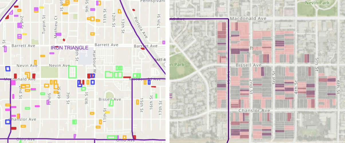
For this walking tour, we provided the community members with a map of all surplus land and other forms of vacant land in Richmond with detailed information on square footage, zoning, and in some cases, housing density potential. Their great interest in this information illustrated the importance of ground truthing data and the power of data visualization, specifically through mapping. While much of the City’s data on vacancy and surplus is publicly available, it can be hard to find on obscure state and local websites, if it is published at all. That’s why I have been gathering data sources on vacancy and developing a spatial inventory of vacant, deteriorated, and/or abandoned land as well as much detailed information on ownership and development potential.

Through the PBF Policy Grants Technical Assistance fund, I retained a Geographic Information (GIS) Specialist and UC Berkeley Urban Planning graduate student, Victoria Beckley, to support the project. Victoria created an online interactive web map which provides a comprehensive landscape of land within the City of Richmond. Victoria also connected us with students in a graduate GIS class, who collected primary data in the Iron Triangle neighborhood of Richmond in order to document vacancy and deterioration, and verify or update public data sources on vacancy. Their data collection has also been mapped. This collaboration has led to subsequent group projects with the students to support Richmond’s policy work which will be completed by the end of the school semester. This type of primary data collection and mapping supports the policy design and can be used, as it was on the walking tour, as a community engagement and education tool.
A Little Imagination Goes a Long Way
The walking tour concluded at the largest of the 8 lots, at the corner of 1st St and Nevin Ave. Community members noted that the site was very close to a large subsidized housing complex at which many of their relatives lived and the need for affordable fresh produce in the neighborhood. They began to imagine both the possibility of housing and a cooperative grocery store on the site, given its size. As we wrapped up the tour, we heard comments like, “Can we do this again?” and “I want to bring my family next time.”
While standing on a vacant lot feels insignificant to so many people, it turns out kindling community members’ imagination and situating it within their own context and experiences can transform the space into real life equitable development possibilities. This has fueled my excitement to finalize a proposal with the City of Richmond staff for the Equitable Public Land Policy. I will continue to work closely with RichmondLAND to ensure community members’ expertise and needs inform the policy development and implementation process.